

Touring a War Zone with Google Maps
Touring a War Zone with Google Maps
Russia’s destruction is visible from space

In late April (on or right before the 26th), Google Maps released a limited satellite imagery update for Ukraine. While many of the towns and places impacted by Russia’s invasion were not included1, a handful of places show the horrific devastation.
Pisky
Pisky is a small village just west of Donetsk. Before the war started in 2014, its population was just a few thousand, but it had fallen to less than 20 by 20152.
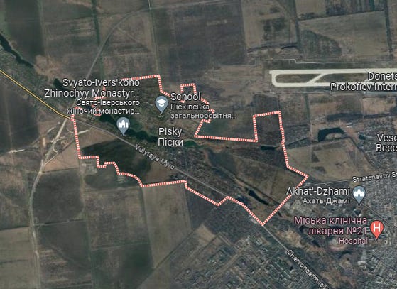
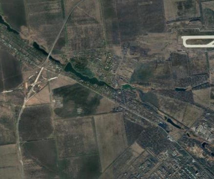
Here the updated satellite imagery cuts right through the city. To the left is what the city and surrounding area looked like before 2014 while the right shows the devastation caused by the Russian army.
Zoomed in, the difference becomes stark. The homes of average Ukrainians are juxtaposed against the rubble of what were the homes of average Ukrainians. The juxtaposition is separated by just yards and time.
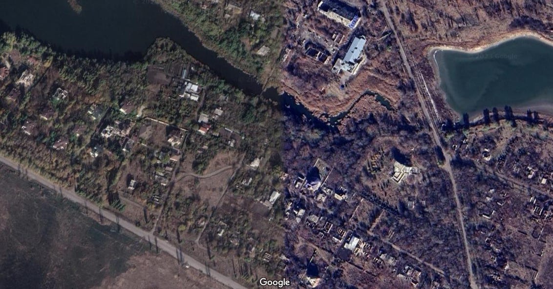
Photos of Pisky today could pass as colorized World War 1 photos— even down to the clearly visible trench networks.

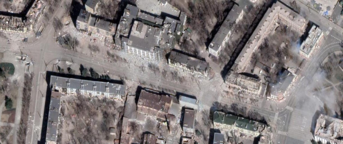
Mariupol
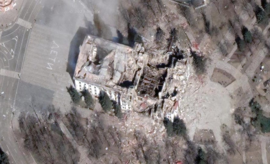
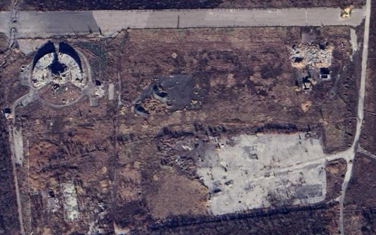
As Russian soldiers attacked Mariupol, Ukrainian civilians began to gather at the Donetsk Academic Regional Drama Theatre in the city center. To help prevent Russian strikes, the word children was written in Russian— “Дети”— in front and behind the theater. On 3/16/22, Russian forces struck the theater with precision weapons anyway. According to an AP investigation, close to 600 civilians died.
The new images show the ruins of the theater and “Дети” still visible on both sides.
To both the east and west of the theater, apartments and homes are in shambles.
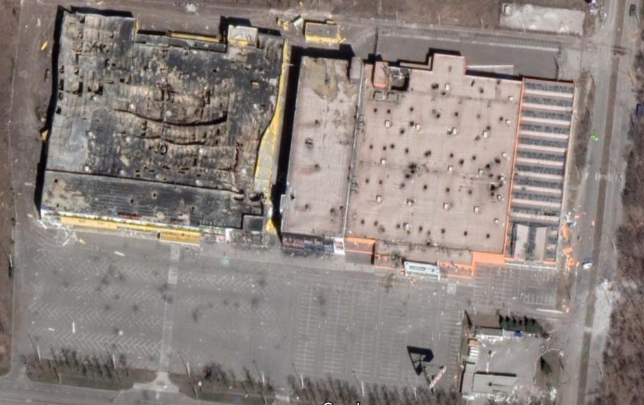
On the western outskirts, what look to have been big box stores have been torn apart by artillery.
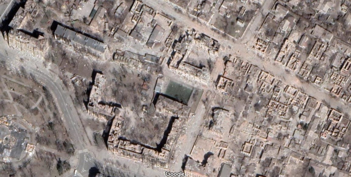
An apartment complex is just across the street. It looks like the one my grandparents live in.
Scorch marks and ruble are clearly visible.
The same can be seen with apartments further north.

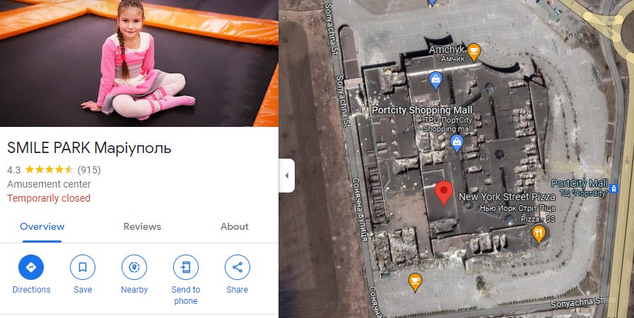
Lastly, I found a mall with a New York-style pizza parlor and trampoline park in it. When you click on it, Google shows a picture of a smiling girl who had her whole life ahead of her. Is she even alive today?
Donetsk Airport
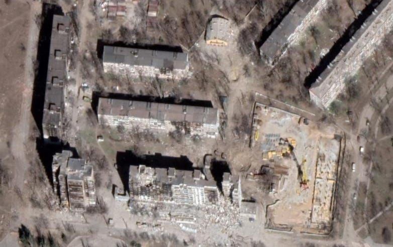
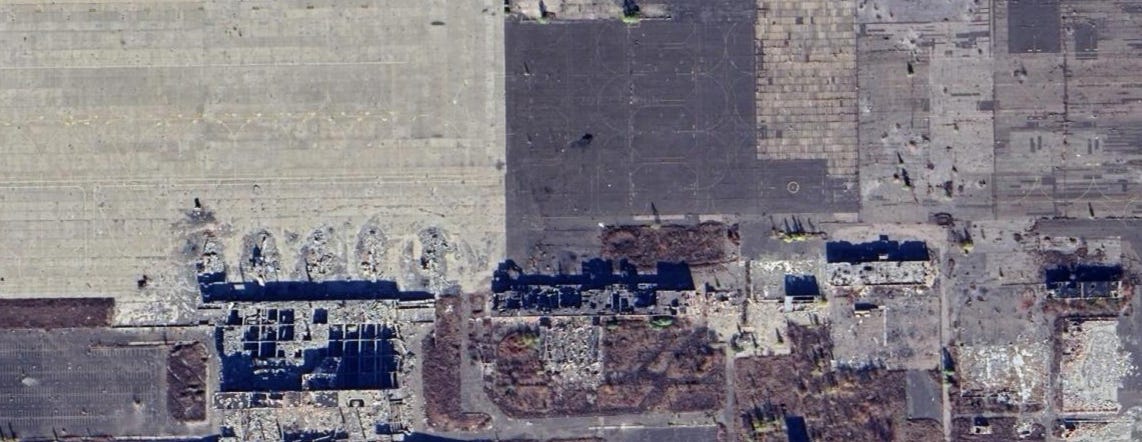
Back near Pisky is what was Donetsk Airport. While the airport was a hotspot in 2014 and early 2015, it hasn’t seen much action since.

First, there is the aircraft control tower which was destroyed by Russian proxy shelling in January 2015.
Close by is a tarmac littered with impact craters, what was the new and old terminal, and other infrastructure. All of it is destroyed and beyond repair. Ukrainian soldiers nicknamed “cyborgs” held these positions under constant attack for months. Today, the airport serves as a graveyard for the soldiers that died defending their country from Russian invaders.
Exit point: Russian propaganda accuses Ukraine of engaging in a genocide of ethnic Russians, yet compare cities like Mariupol and villages like Pisky to occupied Donetsk or liberated Kherson. It is the Russian army that brings death and destruction to where it attacks.
Exit links: Both the Independent and Guardian did similar posts. I didn’t look at them until after I wrote this, but they do cover similar sites. The Independent provides before and after shots while the Guardian has cool interactives.
To be clear, I have no idea why any location was or was not included
The fact it wasn’t zero shows how poor the village was. Even in the face of war, people didn’t have better options.